Saturday, March 30, 2013

A Hidden Gem


One of our books ‘The Great Kiwi Road Trip’ lists our next destination as a hidden gem - Sylvia Flats.  We have been here before and it really is a gem, hot thermal water running into the Lewis River. I had read though that this area was now closed because of a slip but we still thought it was worth checking out for ourselves. There was always the possibility that this had been remedied.  The turn off into this once picnic area is about 2km from Boyle Village but of course we were coming from the other direction so it was tricky.  Luck was on our side, with no other vehicles behind us, we spotted the track and turned in. A quick walk to along to the river confirmed that the area was still in fact dangerous and it looked like no one had been digging out a pool for themselves in recent times. We decided to stay the night in the area anyway as it was very picturesque beside the river and we were well out of the way of the slip. It was surprising the number of vehicles that came in for a look even in the short time we were there.


Stephen soaking in the pool alongside the Lewis River.
However luck was to be on our side. Later on in the evening another van came in and joined us and it was still there when we went to bed. We were nearly asleep when our company called out to us that he had dug out a pool if we wanted to join him. We declined but said we would look it out in the morning.  I don’t think he had been in it all night but he was definitely there again first thing in the morning, enjoying his own private thermal pool.  A short discussion re the safety etc of the area had us decide we would be back after breakfast. Evidently the slip came down during a flood two and a half years ago, and our friend had been there at the time. He said he had been monitoring the site since then and decided that there had been no movement in over a year now and deemed that he was prepared to take a risk. He had fashioned out an excellent sized pool and the water temperature was just perfect. The only complaint were those dammed sandflies again otherwise it was perfect.  As the book says  ‘a hidden gem’ but now obviously it comes with a certain amount of risk.  We thought it was worth it.


A view of the slip caused by flooding in November 2011.

Thursday, March 28, 2013

One for the Geologists


Inangahua and Murchison are synonymous with earthquakes and there is certainly plenty of evidence to be seen. 

A photo from the internet as our
camera batteries went flat!!
Evidence of the 18million cubic metres
of soil and rock dislodged.
We spent a couple of days in Murchison and the local museum is an excellent source of information about how the quakes both affected the landscape and the lives of the people living there. One of the walks we chose to do (recommended by my cousin Stewart who lives there) was the Johnson Creek Walk. A drive 6km along the west bank of the Matakitaki River takes you to the start of this 2.4km walk. The track initially takes you through beech forest and along the side of the creek as it winds its way upwards.  As you come out of the bush the landscape changes dramatically and you could think you were in a moonscape with low scrub. It has been caused by a huge landslide caused by the June 17, 1929 Murchison Earthquake (7.8). Enormous pieces of rock, sand and dirt are lying below the rock faces hundreds of metres above where they let go  over 80 years ago. This track is not well publicised and although it is well formed it is not well worn. We certainly never saw anyone else, just a few wild goats!


Driving from Murchison to Springs Junction yesterday we stopped off at the Maruia Falls, about 15km south of Murchison. This waterfall on the Maruia River is a result of the 1929 Murchison Earthquake. Usually it is an upthrust that causes waterfalls like this but this one is different as the entry in the Te Ara Encyclopedia explains:
The Murchison earthquake of 1929 produced the Maruia Falls through a different process – a landslide in the Maruia Valley, shown by the dotted lines. This diverted the course of the Maruia River further west, forcing it to cut a new channel over an old river bank. Once the river had eroded the gravels, the bank became the Maruia Falls.’ They are very spectacular even with this dry spell of weather. 


Our camp for the night was right on the Alpine Fault line just east of Springs Junction. It was another DOC camp and was well laid out with plenty of good camping spots, water and toilets.  When we went off for our walk this morning we found earthquake monitoring equipment in the form of a 24 metre wall. This was installed in 1964 right through the middle of the fault to observe any movement in the fault line.  It is interesting that to date no such movement has been recorded so even the 1968 Inangahua quake didn’t cause a shift. It is now thought that the plates don’t make small movements but instead make sudden large movements which is typical of all active faults in NZ and around the world. Studies indicate that last movement was probably in the 1660s and it caused the two edges of the fault to move 1.3m horizontally and 0.25m vertically.  We are making assumptions that this a popular site for any students or researchers interested in Earthquakes and their effects as even in the short time we were there, a group of 16 German students were visiting it as part of a field trip.


Tuesday, March 26, 2013

Lyell


I think this place could be renamed ‘Sandfly Haven.’ We had been warned, and also have been here on a couple of other occasions, so we should have known. It is such a lovely spot, in the Upper Buller Gorge, to camp but it is ruined by the hoards of sandflies that just swarm you unless you are moving. Even opening the door of the bus makes them think it is an invitation to join us inside.  One weapon in our artillery against them is to burn mosquito coils in the doorway. It seems to keep them mostly at bay so we could at least sit inside with the door open. Any chance of sitting outside to enjoy a beer at the end of a lovely sunny day was well out of the question. 

The spot we had chosen in this DOC camp gave us a good view of all the other campers as they arrived and set up their camp sites. The ‘sandfly dance’ was what I called it. Everyone was doing it!! One sensible woman had a net over her entire head and face as she attempted to break camp on Saturday morning.  


In moaning about the sandflies we mustn’t lose sight of the fact this place is full of history. The camp has several interpretation boards. Here you can see old photos and maps of the area. At one point 2000 people lived on the site of the camp. Hard to imagine now and what terrible conditions it must have been. Gold mining was what initially attracted people to the area. 


Walking along the dray road.

There is a very good walking track up into the hills to the site of the mine and it follows the journey the miners would have made every day. It takes you up past the old cemetery, high up onto the hills behind and passes through beech forest, over rivers and up onto the original old dray road. The remains of the stamping battery are still there to be looked down on from a viewing platform. The complete loop track took us an hour and a half and was well worth it.  
Looking down on the stamping battery.


Stephen on the viewing platform.


Interpretation board at the mine site.


Part of this track now forms one of the many new cycle trails popping up all over NZ. This one is  ‘The Ghost Trail’ and is listed as Grade 3. It takes you on well beyond where we walked and if you kept going would be back over to the Charming Creek Track near Seddonville that we visited. 


Monday, March 25, 2013

Apple and Blackberry Pie, deconstructed.

Foraging is never far from our minds as we travel around in the bus. 
The day we left Mayfield, back at the start of the end of February we found several apple trees on the side of the road, laden with fruit. So of course we had to stop and fill a couple of large bags. These apples weren't quite ripe and tart would be an excellent word to describe them.  However they have had a week or two to ripen up and are now perfect for that apple pie.


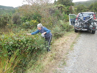
We have been looking in vain for blackberries and we would have to say that this is not a good season for them. We have certainly found lots of blackberry plants growing in all sorts of places but alas little or no fruit. I had thought that maybe that it has simply been too dry, or maybe there aren't enough bees out there (plenty of bumblebees but perhaps they don't like blackberry!)
So we were really pleased to find a good crop up on the hills above Granity, at Millerton and we managed to collect enough to at least attempt a pie.


Collecting berries at Millerton
The bounty.


 So now with the blackberries, out came the apples and soon a dessert was not far away. We have a gas oven for baking and it isn't always very good at browning the food, and pastry is tricky enough at the best of times. However I have found if the pastry is cooked on a piece of baking paper, on its own it puffs up beautifully. I have in the freezer some pastry squares (from Quality Bakers in Invercargill that are an excellent buy at $1 per pack of 10) so I cut the squares in to triangles and baked them.
With the blackberries and apples stewed together with a little sugar all the ingredients needed for my 'deconstructed pie' were ready and it was just a matter of assembling our dessert.

Saturday, March 23, 2013

Exploring North of Westport


Even though I have spent lots of time in this area - well almost 40 years ago now, there were many places for us to see and do that I had not seen before. Many of the walks and attractions have been up- graded, and interpretation boards erected. 


Misty view up on the plateau.

Take for instance Denniston. We have both been up there in the past but considerable effort and money has been spent in recent times to make the tourist's visit more informative and enjoyable. However the one thing that cannot be fixed is the weather and unfortunately our trip up to this truly amazing site was the one wet miserable day that we have had. Of course even on a good day it can be miserable, with stories regaled about how there were times when those living there never saw the sun for three months at a time. 
Looking down the incline
from the new observation platform.
We did brave the rain briefly to view the incline. A new observation platform has been constructed and the view really does put in perspective the stories we have read about the journeys up and down it. We were unable to read many of the interpretation panels as it was simply too wet and cold. Something to leave for another time.

History of Dennison


Remains of the bath house, used by miners
at the end of their shifts.
Concrete path leading down to
the township from  the bath
house.

Later in the day we drove up into Millerton and Stockton to have a look at the current mining programme, as well as to seek out some of the historic sites. The old miners bath house is one such site and there is certainly plenty of history here.


View from Zigzag track down on to beach and DOC camp.

It is 39 years since my last trip to Karamea (not so long for Stephen) and it is amazing just how much you can remember even back that far. We drove on to Kohaihai, the start of the Heaphy Track. I have a photo of me swimming there all those years ago, and another on the swing bridge. That particular bridge is now lying discarded on the edge of the new DOC camping and parking spot. In its place is a new rigid bridge which certainly makes for an easier crossing. We chose to walk along the track as far as Scott's Beach.  
Resting on Scott's Beach


We found this track an easy walk and now think that we would be great to walk the whole of the Heaphy Track.  Lots of insect repellant would be a must as they really can make it unpleasant. Fortunately both of us seem to be immune to their bites, as otherwise would be covered in very itchy lumps.

A new place that has opened up in the last ten years is the road into the Oparara Basin. This 14km trip is over a narrow, and very rutted gravel road and by the time we got to the car park we were hoping that it was going to be worth the effort. And we weren't disappointed. There are magnificent arched rock formations formed in the limestone by the river. We walked into all four that are opened to the public, and each one is unique. The final two required a torch (remembered this time) and were quite spectacular. The interpretation boards, in the shelter/ toilet area are a credit to DOC and cover every aspect of what the area has to offer. 


The bush is in fantastic condition, the river full of brown and orange water created by the tannin from the bush, and it is full of bird life though we could hear more than we saw.  
River stained by tannin.

Old mining relics abandoned.
Coal mine.
Charming Creek Walkway was the last activity in the area that we planned to do. Unfortunately signage in the area is not the best, with the largest sign indicating this walk, not being the better end to walk from. We drove up to Seddonville and drove in through a logging road before realising we should have been at the Ngakawau end (only metres from where the bus was parked). We did however see some interesting mining relics including coal mines and were glad that we had seen this part as well. 

We returned to Ngakawau and found a very small insignificant sign pointing to the track so walked about half an hour a long it before returning out the same way. It is an easy walk along the path of the old private railway line that was used for both coal and timber. It is three hours to the other end we were at, and you either would need someone to pick you up from there, or make it an all day walk in order to return to the start.


The Ngakawau end of 
the Charming Creek
walk.


Just as we were organising ourselves to leave our camping spot at Hector, our friend Liz came along and we were able to say our goodbyes. Liz is a former volunteer at the Southland Community Nursery and she now lives in Hector just across the road from where we were parked. We spent a couple of evenings with her and Ron and it was great to be able to enjoy some local hospitality.

Thursday, March 21, 2013

Cape Foulwind


After a night parked on the back beach behind Tauranga Bay, (near Westport) we packed our lunch, and biked around to the start of the Cape Foulwind Walkway.  This is a very well formed track and very popular with the tourists. Evidence of this was the very large carpark, complete with mobile Muffin and Coffee shop.

The track is divided into stages, with a short wheelchair access section up to the lookout down on the the seals. You could spend ages looking down on this colony watching their antics and at this time of the year the cubs are still there and very active.


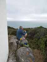
We decided to walk onto the lighthouse which was a little more strenuous and took us about an hour. We had packed our lunch and sat at its base and enjoyed the views. A quick walk down to the carpark at the Cape Foulwind saw us heading back to our end at Tauranga Bay. 


You can imagine our surprise when saying our ‘hellos’ to a couple we were passing in the other direction were friends from Invercargill. Neither Jenny or I knew that the other was in the area. We couldn’t have arranged it if we had tried!!!!


Wednesday, March 20, 2013

Fox River


This river is north of Punakaiki and a site with a good deal of history. It was the point where a pack track went up into the hills to go south, before the road went down along the coast. 


If you are inclined you can still walk this track over the top and back down into Punkakaiki. In the 1970’s a commune of ‘hippies’ set up here, in an attempt to live a self sufficient life and the caves by the beach, were used for Rock concerts.


It is here that we spent the weekend parked beside the bridge. Shirley and Rami came out and joined us on Saturday. The boys fished, Shirley had a swim and we explored the immediate area.  We sat on the beach at night and cooked our fish and baked our potatoes. A thoroughly enjoyable evening.


On Sunday we walked up the first part of the pack track to the ‘Caves,’ that are much further inland. This walk (90mins each way) took us through the bush alongside the river, across the river on two occasions and then up the cliffs to the caves. It was a spectacular walk and climb, and we more or less had it to ourselves, meeting only two other couples on the way out. We were unable to enter the cave as we had forgotten to take a torch!!! (will need to remember for such activities in future) but it was still worth the effort. The interpretation board gave a good history about the area, and how in the early 1900’s guided tours were taken by the publican at the local hotel, for ₤2/6. It was the publican who had built the track both up and into the caves. Only the upper cave can now be entered as the lower one has had large rock falls, so we weren’t too concerned about not being able to enter the upper one. 


The lack of rainfall in the area was certainly evident even in this normally damp area. The river was very low in places, (just as well as I wouldn’t be confident at crossing it) and some of the bush was showing signs of stress. A light rain was starting to fall as we headed back to the bus though it would need to continue for several days to be beneficial. 

Monday, March 18, 2013

Greymouth


What a fantastic week we had in Greymouth. For those on holiday in the area, the weather was perfect, though it is extremely dry and not so good for those who need moisture for their farms and gardens. 
We spent most of our time camping beside the Grey River at the Cobden Bridge. The council provide a waste dump, fresh water and rubbish bins. It is very close to the town centre and a short walk to our friends, Shirley and Rami’s place.


Camp site close to town centre.

View from the hill above our camp site.

View of the Grey Valley from King Park Track. This track
is behind Shirley and Rami's place in Greymouth.


We did lots of walking, cycling, fishing and had several picnics. The walks ranged from half an hour to up to three hours. The bush is never far away when you are on the Coast and it is so easy to make use of all the tracks that are about.


One walk  we did was the Pororari River track which takes you in a loop from from the Punakaiki River, over the ridge and down along side  the Pororari River and back to the main road. 


Shirley and Stephen thought it would be great to have a swim as the water looked very inviting. Even with the lower than normal river levels the water was still fairly cold. I must say that I was very pleased that a walking bridge has now been erected over the Punakaiki River, as last time we did this walk we had to walk through it. I must have a low threshold to cold as it was so painful.  We finished this three hour walk with a picnic tea.  Shirley loves a picnic and is very good at organising a feast quickly.


Two such picnics in progress, one at the end of the Pororari River track, and the other while watching the 'boys' fishing off the rocks at the 12 Mile. This is where Stephen almost got his snapper.


We did one big bike ride along the start of the new track that takes you from Greymouth down to Hokitika and beyond. We did a good 20km round trip, going just beyond Paroa (close to turn off to Shanty Town.)
Stephen and Rami did lots of fishing - both in the sea and the river. They weren't quite as successful as we had hoped though they still caught a trout, several butterfish and mullet. Stephen had a snapper on the line one evening but it managed to wriggle off. Eating fresh fish is an experience that is hard to beat.

Fishing off the Cobden Beach

The sun setting on Cobden beach.

Fishing for Kahawai in the Grey River.

Trout fishing in the Arnold River.

Fishing off the rocks at the 12 Mile.